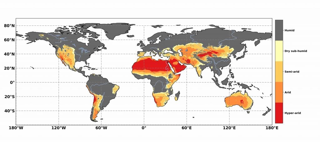
Geographical distribution of drylands, delimited based on the aridity index (AI). The classification of AI is: Humid AI > 0.65, Dry sub-humid 0.50 < AI ≤ 0.65, Semi-arid 0.20 < AI ≤ 0.50, Arid 0.05 < AI ≤ 0.20, Hyper-arid AI < 0.05. Data: TerraClimate precipitation and potential evapotranspiration (1980–2015) (Abatzoglou et al. 2018).